In January of 2020 I sat in master control at KING TV and watched with some trepidation as the Diamond Princess returned to port in Italy and was quarantined. It was only a week or two earlier that Darlene and I had finalized our travel plans for a trip to Europe. We were to fly into Rome in June, spend a week seeing the sights then take the train to Venice where we would meet her family for a cruise to Croatia and Greece. It had been in the works for months. I had spent hours searching the internet for the perfect accommodations and flights. As time passed the plan began to change, the cruise was cancelled first. Everyone agreed that being in close quarters with any illness sweeping Europe would be ill advised. We would simply spend those two week in Italy. Then finally as the true seriousness of the COVID-19 pandemic began to become apparent, the entire trip was scrapped. We were lucky, after many hours spent on the phone and monitoring chat windows we were able to recoup the money we had spent, and everyone was safe and healthy. It was hard to complain given what we were seeing in hospitals around the world. Europe could wait.
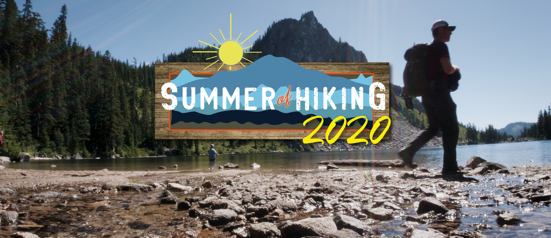
We were left with a few weeks off of work in June, and no real options for how to spend them. Nothing seemed safe anymore. Travel, even close to home was simply out of the question. The only thing that seemed to be even remotely possible was to stay in Washington and explore nature, to get outside and away from other people. So that is what we did. We started with some more popular hiking options, Franklin Falls and Deception Pass State Park. These seemed to attract too many people, defeating the purpose. So we sought lesser known trails. I had my camera as always and shot video of our adventures. The folks at KING saw the first two videos and asked if they could use them on the "Explore the PNW" portion of the company web site. I agreed, and this series was born. I wrote the articles below to go with the videos and submitted one or two a week throughout the summer, a couple even aired on New Day NW. I initially planned on shooting 10 episodes, but ended up with 9 shot and 7 published before the skies filled with smoke in late August. The idea of sending people out into the wilderness with extreme wildfire danger looming and smoke clogging the air seemed unwise. So those final two episodes were never published. I am unsure what will become of them now, the videos sit on my computer awaiting a home, time will tell. I'm not especially anxious to revisit the climb to Pinnacle Lake that ended with me and my camera in the water to be honest. The seven episodes that made it to the web are below in the order I wrote them, although they weren't shot in this order, Maury Island was actually first. Aaron Taylor and Jim Goodreau were kind enough to let me use their music and for that I am very grateful. KING also let me write my own Bio which you will find at the bottom of this page... Enjoy.
We included the links below on multiple articles, especially as the trails got busier and busier. Please be responsible when enjoying our natural areas. The guidelines here are a good start.
Cheers
Ben Rupp
Summer of Hiking - Episode One "Lodge Lake"
"The year 2020 has been anything but normal, and getting outdoors has been a saving grace for many. Learn more about exploring Lodge Lake near Snoqualmie Pass."
My wife and I are NOT expert hikers. In a typical year we might hit the trail 3 or 4 times if we are lucky. 2020 is obviously NOT a typical year. As the pandemic stretches well into summer, we like many have been struggling with the effects of stay at home orders. Events have all been cancelled, the stores are closed, it seems like the virus is waiting around every turn. A person can only take so many walks around the neighborhood, can only clean out the garage so many times. Eventually you NEED to get out into the wild, to smell some fresh air, to feel the sun on your face. Luckily Washington is endlessly beautiful and brimming with trails.
Being outside, away from other people just seems to make sense. Everyone you pass on the trail has a mask at the ready and pulling off the trail to allow for social distancing is easy in all but the most extreme cases. It’s for these reason that we have declared 2020 “The Summer of Hiking”.
What we lack in hiking experience and know how we make up for with enthusiasm and being constantly out of breath. We will be taking weekly hikes (sometimes more) and will share some of what we experienced with you here. To ensure safe hikes we will do our best to avoid the most popular and crowded trails. So, grab your boots, water bottle, sunscreen, insect repellant and a facial covering and get out and explore this amazing state with us.
This week we head 51 miles east of Seattle to the Summit at Snoqualmie, a place we know very well, although it looks much different when we usually see it blanketed with snow. As it makes its long journey from Canada to Mexico, the Pacific Crest Trail cuts across Summit West. We will be hiking a roughly 2-mile section of the PCT out to Lodge Lake and back. The trailhead is in the upper corner of the parking lot, turn right into the main lot and head as far up and to the right as you can, and you can’t miss the trailhead. The trail ducks briefly into the trees before bursting out in a vast field of grasses and wildflowers. It cuts dramatically under the lifts gradually rising 800’ before heading back into the forest at Beaver Lake. You will cross a few bridges and even a free-flowing stream as you descend from Beaver lake to Loge Lake. Be vigilant, it is easy to miss the Lodge Lake spur if you aren’t paying attention. The sign is tacked to a tree just above eye level. The edges of the lake can be a muddy, but there are plenty of logs to keep your feet and bottom dry as you relax next to this tranquil mountain lake. There are several camp spots dotting the lake’s south shore. These, like most site in the National Forest, are first come first serve. If vacant they make a great place to stop for lunch before heading back up the trail the way you came.
Until next time, happy hiking, stay safe.
Music By Coleslaw Taylor.
Summer of Hiking - Episode Two - "Maury Island Marine Park"
"The drive to Maury Island Marine Park may be worth the ferry ride on its own."
This hike required a quick ferry ride from our neighborhood in West Seattle to Vashon Island. As you leave the ferry a very large sign on the side of the road reminds you that the average age of residents on the Island leaves them at a higher risk for complications from the corona virus. They simply ask that you abide by all guidelines required to limit the virus’s spread. While hiking may be one of the safest activities one can undertake during this pandemic, you still need to make conscious efforts to maintain social distancing. It is generally a good idea to pull off the side of the trail to allow other hikers to pass, and please always keep your face covering handy, especially when the trail is narrow.
Maury Island is not actually an island. It’s a peninsula clinging to the south end of Vashon island. The drive to Maury Island Marine Park may be worth the ferry ride on its own. Vashon is a lovely combination of Seattle suburb and rural farmland. Due to its bucolic nature the road attracts many cyclists, so be vigilant.
The park has three separate trailheads. One leads directly to the upper forest loop and has a pit toilet, the second is located to the right of the viewpoint overlooking the park and the third is at the head of the park’s access road, a steep gravel lane that leads to a picnic area above the beach. We started our hike at the viewpoint. From the deck the trail traces a path across the top of the bluff before reaching a fork, to the left is the switchback path leading down to the water, the right leads into the woods. We started with the forest loop. The trail crosses a beautiful meadow and winds through a forest of alders and rare pacific madrones before arriving back at the fork. We then followed the trail down to the Puget Sound below. Although it bears the scars of its former life as a mine then a working gravel pit, the park is now a steep meadow of grasses and wildflowers dotted with plenty of shade trees. The trail is open to biking and equestrian use; you are likely to encounter both as you descend towards the sound. The trail drops 500’ before spilling out onto a gravel beach covered in driftwood. The beach features primitive camp sites accessible from both the trail and the water. We walked the mile of shoreline before heading back up the bluff at the access road. One of the park’s main draws is a gorgeous view of Mt Rainier and the Cascades, unfortunately during our visit the mountains were hidden by a band of clouds. Even without the view the park is well worth a visit and is seldom busy, making it a very safe hiking option during this pandemic.
Music by Coleslaw Taylor
Summer of Hiking - Episode Three "Sheep Lake and Sourdough Gap"
"The section of the Pacific Crest Trail that takes hikers past Sheep Lake and over Sourdough Gap shows amazing views of neighboring mountains."
It's the Summer of Hiking! Simply because being outside away from as many people as possible seems like the only alternative in 2020. Bring some water, some good boots and a face mask, just in case. Washington is beautiful go explore it.
Darlene and I have tried to avoid very popular hikes with this series. The point is to get out in nature and away from people. We also tend to look for shorter hikes that feature water. Bonnie (the dog) is getting older and is extremely furry, we really don’t want to overheat her. This has made trail selection a bit of a challenge. Sheep Lake/Sourdough Gap is borderline too popular, but it is somewhere we have wanted to go for a long time. We had to risk it. Other than the first and last half miles, the trail is plenty wide enough to allow safe trail passage. Luckily everyone we saw was appropriately masked and made every attempt possible to provide safe social distances.
The area around Mt Rainier is gorgeous, this is no secret, it’s bafflingly beautiful. Nearly any trail will take you to amazing sites. One of these is the section of the Pacific Crest Trail that runs past Sheep Lake and over Sourdough Gap. You will find the trailhead just on the eastern side of Chinook pass, across from the very popular Naches Peak Loop Trail and a stone throw from the incredibly busy Tipsoo Lake. Don’t let the lack of parking scare you away, since many people destined for the busier trails park at the Sheep Lake Trailhead.
The first half mile or so of the trail rises in parallel to the descending highway 410. It is a mountain goat worthy path perched on a narrow ledge. The 400’ of rise to Sheep Lake is very gradual and barely noticeable, save your water and energy for the later haul to Sourdough Gap. Before long the trail begins to duck in and out of flowery meadows and darkly shaded forest, some still clutching the last remnants of winter (Bonnie was extremely excited to see snow). You will likely hear the lake before you see it, as the laughter of children playing in the water echoes off the surrounding cliffs. Then an emerald green gem will appear before you, hugged by a steep promontory on three sides. The lake is circled by camping sites that fill up rather quickly, but you should easily find a place on the shore to relax before undertaking the more strenuous portion of your journey. A large rock jutting into the lake on your left is a very popular break location, for good reason.
The trail then wraps around the south side of the lake, crossing a roaring stream as it goes. It’s only a mile to the top of Sourdough Gap, a narrow breach in the ridge line above Sheep Lake. Most of the journey is a leisurely stroll through meadows and rock falls. It’s only the last quarter mile or so that will get your heart pumping, as the trail rises steeply and cuts a path back and forth up an exposed rocky face. It is well worth the effort. Once you crest the top you will be greeted on one side by the Crystal Lakes basin, likely still dotted with patches of snow and behind you a view of Sheep Lake and the Cascade volcanoes. Take a break among the craggy ridge to regain your strength before descending back the way you came, maybe even stopping to cool off in the chilly waters of the lake below.
Until next time, get out and explore Washington, wear your mask.
Music By Coleslaw Taylor.
Summer of Hiking - Episode 4 "Iron Goat Trail"
A beautiful stroll through NW railroad history as the forest reclaims the rail line”
Darlene and I aren’t alone in our desire to #optoutside during the pandemic, trails have been much busier than normal. As a rule, we don’t hike a trail if the parking lot at the trailhead is full. Luckily it is very easy to find a back up if the trail we were hoping to hike is too busy. The point is to get outside as safely as possible. You don’t need to wear a mask the entire time you are hiking, just put on the face covering when passing other hikers or when the trail doesn’t allow for safe social distancing. It also seems worth mentioning that not all facilities are open at all trailheads, check trail reports and web sites before you head out, and please if you bring it with you pack it out. There is nothing worse than seeing other people’s garbage on the trail. There is room for all of us if we all just take the time to hike safely and consider others. If you are concerned about over-crowded trails you can always hike on weekdays or you can do what we do, go early in the morning. When we arrived at the Marin Creek Trailhead to hike the Iron Goat Trail, we were greeted by an empty parking lot and beautiful early morning light.
Named in honor of the Great Northern Railroad logo, Iron Goat Trail is a gentle stroll through NW railroad history. The trail follows the railroad grade as it climbs a portion of Stevens Pass in a six-mile loop between the Martin Creek and Scenic trailheads. It also includes a three-mile spur trail to the former town of Wellington, the site of one of the nation’s worst rail disasters. On March 1st, 1910 the passenger train the Spokane Express had been stuck in Wellington for weeks, glued in place by the notorious “cascade concrete”, wet and heavy late winter snow. Then the unthinkable happened. An avalanche swept the express and a nearby mail trail from the tracks, killing nearly 100 passengers and crew.
Now the main attractions of the Iron Goat Trail are the remnants of the snow sheds and tunnels built to help prevent another tragedy. At the time these structures were engineering marvels, now the tunnels and sheds are in various stages of collapse as the forest reclaims the grade, only a few are safe to enter. The trail is dotted with signs and kiosks detailing the history of what was at the time of its construction the norther most transcontinental rail route in America. The hike can be eerie, as the sounds of the current rail line below can be heard while you peer into the past.
The loop trail is very popular. We started at Martin Creek and headed up the grade in the clockwise direction. A counterclockwise hike will include a very steep series of switchbacks at the halfway point near the Scenic trailhead. You will gain the 700’ in just shy of a mile. Hiking clockwise spreads this gain out over nearly the entire length of the trail and includes a hike down the switchbacks instead of up them. Since most hikers choose the easier clockwise option this trail provides excellent opportunities for social distancing, you will seldom encounter other hikers on the upper grade.
While the upper portion of the railroad grade can be slightly overgrown and narrow in places, (especially the spur trail to the old wooded spillway and reservoir) the lower grade’s three miles of ADA certified trail is wide enough for easy social distancing. At the halfway point of the loop you will encounter a split in the trail, to the right is the spur leading down the switchbacks to the lower grade, the left is the trail that extends another three miles to Wellington. A quarter mile up the trail towards Wellington you will find the Windy Point Overlook, an excellent spot to take a break and enjoy a lovely mountain view before heading down the switchbacks to the lower trail.
The Scenic trailhead is the only of the three that currently has usable bathrooms, the others are locked due to the pandemic, so you may want to take a quick break here. The trail is very shady and features plenty of streams for your four-legged friends to cool off in.
Safe hiking.
Music provided by Jim Goodreau.
Summer of Hiking - Episode Five "Greenwater Lakes Trail"
"The hike has a minimal elevation gain spread out over nearly 2.5 miles making it easy for families and children. It does require a NW Forest Pass."
Ralph Waldo Emerson famously said that it’s not the destination that matters, it’s the journey. He could very well have been talking about the Greenwater Lakes trail. The lakes themselves are not really the reason to undertake this hike. Don’t get me wrong, they are lovely little pools where the Greenwater River slows to a crawl, but the trail itself is simply stunning. This is a rare trail combination, beautiful and very easy. With its minimal elevation gain spread out over nearly 2.5 miles this trail is extremely popular with families with small children, kids seem to love the numerous bridges crossing the river.
The area around USDA trail #1176 can be busy in the summer months. FR 70 leading to the trailhead can look like a campground, as cars, recreational vehicles and tents pack every pullout, sandwiched between the road and the Greenwater River. This is a hike that is best undertaken in the early morning, when the campers are still sleeping and the only sound you will hear is that of flowing water. The trailhead parking lot will fill rapidly as the day progresses and locals arrive to escape the heat under the tree canopy. Be sure to bring your mask, you will need it on your return voyage as the trail becomes more crowded and the likelihood that you will encounter other hikers increases. The trail is generally wide and provides ample opportunities for social distancing, but the many bridges are narrow and will likely require you to wear your mask. Many overnight hikers park at this trailhead and either camp at the Greenwater Lakes or further up the trail at Echo Lake.
You will start your journey under a canopy of evergreen trees. The forest here is thick and the trees large. The trail is blanketed in a deep coating of fallen needles, muffling your footsteps. It’s a very peaceful walk in the woods. Before long, you will begin to hear the rumble of raging water as you approach the Greenwater River, your companion for the rest of the hike. The trail takes a sudden dip, and on the right, you will find a short spur trail giving you your first chance to see the river up close. As you continue you will cross over multiple log bridges, each accompanied by a ford for equestrian use. Then the trail rises as the river briefly enters a deep gorge. One last bridge will give you your first glimpse of the first of two small lakes. These pools of crystal-clear water are separated by yet another short gorge where the river roars free and the trail clings to the riverbank. While not quite as stunning as many of the other mountain lakes dotting this area of the Cascades, they do provide excellent camping opportunities, or in our case simply relaxing spots to stop for lunch before heading back down stream.
Be sure to pack out whatever you pack in with you. While the bathrooms at the trailhead are open, garbage collection may not be as frequent as previous summers, so count on taking your garbage home with you. To quote a second cliché in one article, “Take only photographs and leave only footprints”. Together we can keep our trails clean and safe.
Happy hiking.
Music provided by Jim Goodreau
Summer of Hiking - Episode Six "Lake Valhalla"
As I stated at the start of this series, Darlene and I are not expert hikers. We do not possess an encyclopedic knowledge of trails. We have found our destinations like everyone else, from the web or word of mouth. We do our research, but these trails are not secret. The reasons I am shooting these videos and writing these articles are twofold:
One, while there are plenty of articles and trail reports about the hikes that we select, we had a hard time finding videos or photos that showed the actual trails. There are plenty of pictures and videos detailing the destinations, but little about the journeys.
Two, we felt that many popular destinations were too crowded and wanted to show some alternatives. This was not an effort to make these new (to us) trails crowded or to get people to go to them per se, it is just to show that if you look hard enough you too can find places where you can get out in nature safely.
These aren’t the only hikes; they are just a sampling of what this state has to offer and how we have spent our summer.
There are commonsense rules that some hikers seem to be ignoring these days. We don’t hike trails if the parking lot at the trailhead is full. Our desire is to get outside safely and to avoid crowds and a full parking lot is a telltale sign of an over-crowded trail. There are so many trails in this lovely state, it’s not difficult to have a backup plan. We also make it a point to leave the trails in better shape than we found them. We don’t pick flowers or venture off trails beyond the few feet needed to provide social distancing. We also not only pack out what we pack in, but we make a point to pick up some other garbage if we see it (I keep a one-gallon Ziploc bag in my pack for this purpose). We also clean up after Bonnie (the dog).
Services at most parks and forests have been cut due to the pandemic and there are more people than ever out exploring, it is imperative that we all do what we can to ensure that these beautiful natural areas stay that way.
The parking lot at Lake Valhalla was nearly full when we arrived a little after 9 am on a Sunday morning. We were staying in a cabin on the Wenatchee River nearby and very much wanted to hike this trail, so finding parking in the lot was a blessing. The trail was busy but everyone we encountered donned their masks as we approached, and the trail provided opportunities to safely step aside to allow others to pass.
Who knew that the majestic hall of slain warriors presided over by the Norse god Odin was in the cascades just east of Stevens Pass? Its roof adorned with the golden shields of those lost in battle, an endless feast contained within. Well, not really, this Valhalla is filled with families escaping the summer heat and dogs chasing sticks thrown by barefoot hikers. While lacking the golden roof of Norse Mythology, this lake lives up to its mythical counterpart. It’s stunningly beautiful.
There are two paths to this Valhalla and neither involves dying in battle. The first path starts in the Stevens Pass parking lot and is the longer of the two, the other departs from the Smithbrook Trailhead on Forrest Service Road 67 a few miles east of the pass. We chose the latter and shorter, at around 6 miles round trip, for our journey. Most of the 1300’ of elevation gain is made in the first mile between the trailhead and the Pacific Crest Trail. The switchbacks, while numerous, are not all that strenuous and the trail is not overly technical. Once you meet up with the PCT the path levels and gently climbs to Union Gap, a small notch between Mt Lichtenburg and Mt McCausland. Even in late summer you may find snow tucked away just off the trail, Bonnie was thrilled to see the cold white stuff.
Once you crest the gap the rocky peaks of the North Cascades appear on the horizon as the trail begins to descend towards the lake below. The trail levels again and you will encounter a large camping area under an old rock fall (there is no camping on the lake itself). To the left you will see a small wooden sign pointing the way to the lake (an arrow and “lake access” carved into it), to the right the PCT continues its journey south to Mexico. After a flowery meadow you will be greeted by a large flat rock outcropping, the dramatic rock face of Mt Lichtenburg rising from the water before you. Slightly hidden trails to either side of this rock will lead you to two sandy beaches lining the shores of the lake. This trail continues around the north end of the lake and can be a bit of a challenge. Luckily there are plenty of places to spread out on the lakes edge for a quick lunch or swim before heading back up the trail.
Happy hiking, stay safe.
Music by Jim Goodreau
Summer of Hiking - Episode Seven "Ashland Lakes"
"With its elaborate boardwalks and series of pretty little lakes, Ashland Lakes trail provides a family friendly alternative to its much busier neighbors, just be ready for a harrowing drive.”
The trail requires a NW Forest Pass.
The north east side of Mt Pilchuck is dotted with beautiful mountain lakes. Unfortunately, they are no longer a secret. Any weekend morning the trailheads for Lake 22 and Heather Lake will be full, cars spilling out onto the shoulder of the Mountain Loop Highway for literally miles in either direction. These lakes are beautiful and make for excellent hikes, but with the pandemic still in full effect we looked elsewhere for a less crowded option. A mile or so past these busy trailheads you will find FS Road 4020. This is not a road for the faint of heart, or for low clearance vehicles. In fact, it is easily the worst forest service road we have driven on in recent memory. Loose gravel and gigantic potholes will greet you the second you pull off the highway, waiting to swallow you whole. If you are driving an SUV or a pickup you will have no problem, if you take it very slow. I would not recommend this road and hike if your vehicle doesn’t have a high clearance. The payoff for this sometimes-harrowing drive will be an empty trail.
While not nearly as stunning as its neighbor lakes, this is still a beautiful hike, and the tradeoff a lack of crowds. The three lakes you will encounter are lined with boardwalks and campsites that may be deserted even on the busies of weekends. When we arrived at the Ashland Lakes trail early Sunday morning in late August there were two other cars in the lot. When we finished our hike four hours later there was one.
The trail begins as a gentle walk on an abandoned logging road. The grade is easy, the trail smooth. After crossing a bridge, the trail begins to rise slowly. The transition from old logging road to modern trail is so gradual that you will likely not notice until you find yourself on the first of the seemingly endless series of wooden boardwalks. These boardwalks, the trademark of this trail, span the marshy forest floor keeping your feet dry and the sensitive ecology preserved. Please stay on the trail as much as possible.
The first lake, Beaver Plant Lake may be the pretties of the three. The trail drops down through a couple of camp sites to the lake’s edge, where yet another boardwalk will keep your feet dry as you enjoy the view. Once you have had your fill of this little blue gem backtrack back to the fork in the trail and head towards Upper and Lower Ashland lakes. Even more boardwalks will greet you.
The boardwalks are thin at times and occasionally make social distancing difficult, luckily you won’t see that many people on this trail and there are plenty of breaks in these elaborate wood structures where the trail widens to allow for safe passage. You should keep your face covering handy just in case. Upper Ashland lake is very similar to Beaver Plant Lake, the boardwalks hug the shoreline and there is a small wooden platform that makes a great break spot. There is also a pit toilet that was open and functional when we visited.
The trail descends substantially on its way to Lower Ashland Lake. This last lake has the most campsites of the three. Unfortunately, at the time of this article a good portion of the shoreline had been flooded by what appears to be a fresh beaver dam blocking the lake’s outflow. A section of the boardwalk and a couple of the campsite are inundated. Some of the trees lining the shore are gradually turning brown as they die from the flooding, the water is a deep tea brown. If you leave the trail just before the boardwalk disappears into the water, you can safely rejoin the trail by walking through a large campsite. At the north end of the lake you will cross a bridge that provides a very nice view of both the lake and the new beaver dam. The remaining dry campsites provide an excellent breaking point before heading back the way you came.
Happy hiking.
Music by Jim Goodreau
About the author: Originally hailing from the Southwest Washington coast, Ben Rupp has been a Washington state resident for all but two days of his life, the first two days. His mother gave birth a week early while visiting family in Oregon. He eventually forgave her for this misstep. When he is not pushing buttons as an engineer at KING 5 News, Ben can be found snowboarding, skateboarding, traveling, digging through record stores for obscure vinyl records and going on adventures with his wife Darlene and their 65-pound husky mix Bonnie, all with a camera firmly attached to his person.